Geographic Business Intelligence, Geo-BI, another software sales buzzword or something worth investigating further?
Technology companies love their acronyms, usually 3 letters, CRM, ERP, GIS the list goes on. Now, hot on the heels of the “Big Data” concept comes Geo BI; but what on earth is it? 
Simply put, visualising company data using geographic mapping applications can reveal much more than graphs, charts and tables can on their own.
This is not a new concept I hear you all crying which it true, but..
Up until recently, functions like geographic mapping and business intelligence resided in separate applications. If you wanted mapping you needed to buy a geographic mapping package, if you wanted to slice, dice data and share it round the organisation a BI tool was required.
Historically mapping applications were stand-alone software packages built up using expensive cartographic layers of information. Google maps changed all that.
Geo Business Intelligence therefore is the convergence of geographic mapping functionality with the best qualities of business information systems.

We’re collecting a phenomenal amount of data on a daily basis about our customer interactions through a myriad of channels, 24 hours a day, every day of the year.
Senior stakeholders are being asked to make decisions which require the ability to turn all of this data into meaningful analysis.
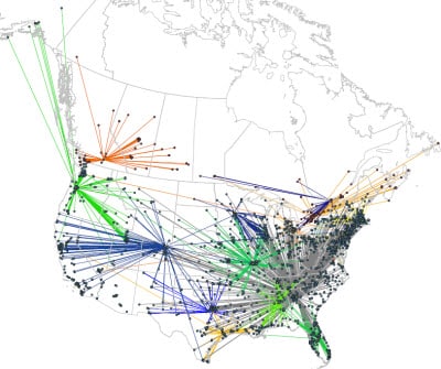
Take the example above looking at the U.S, a simple question such as “do I have enough sales territory coverage” is nigh on impossible to answer via a Geo-BI tool alone. Add a map dimension and the answer springs off the page. 
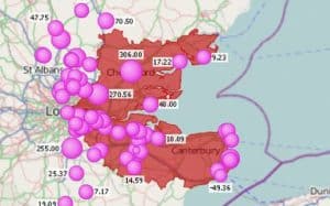
This diagram shows customer groups by value, sure a chart would show the same answer, but in this example we’re able to show how valuable a customer is by the size of bubble and also where the customers are physically located to points of interest such as a store or where our reps are based. The Geo-BI part of the equation allows us to drill up, drill down and add differing layers or dimensions of data such as products, seasonality or even overlay a prospect list against our customers.
Geo-BI is not a new concept, businesses that harness its power are able to react in a more informed and agile way than those businesses that are still viewing the world in 2-D.
To see Geo-BI in action using your own data please get in touch.
